Researchers from the HUN-REN Centre for Ecological Research (HUN-REN CER) and the HUN-REN–UD Functional and Restoration Ecology Research Group recently examined the delineation of the Eurasian forest-steppe zone by László Erdős and his colleagues in 2018 in more detail from a macroclimate perspective. According to the results, it is not worth studying forest-steppes as a single zone, because a more detailed and more credible picture of the environmental factors determining their distribution can be obtained after dividing them into regions. The study presenting the research was published in the prestigious journal Scientific Reports.
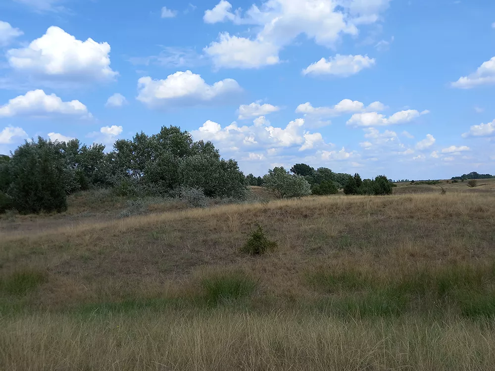
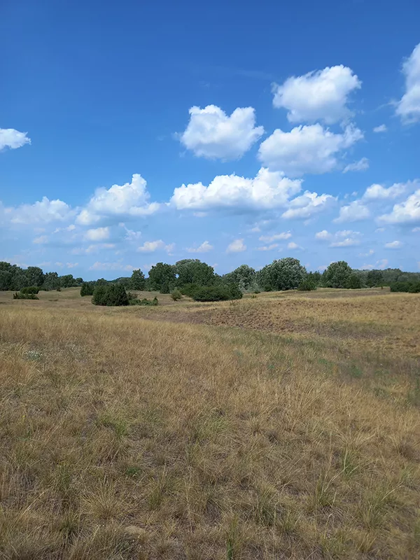
The 9,000 km long Eurasian forest-steppe zone forms a transition between temperate forests and steppe and is a complex mosaic of herbaceous and woody habitats. Thanks to its structural diversity, it hosts numerous valuable or endangered species and its conservation importance is unquestionable. Despite this, until recently there was no empirical delineation of the zone on a continental scale. Finally, in 2018, László Erdős and his colleagues delineated the extent of the zone based on vegetation, topography, and climate.
The question arises as to why it was necessary to wait until 2018 for the delineation of the zone and why it was necessary to examine and confirm this delineation on a climate basis. The reason is simple: on the map, the forest-steppe zone seemingly covers a large contiguous belt of Eurasia, but the reality is more complex. Much of the area of the zone is currently under agricultural cultivation, or, possibly, afforested, and only a small proportion of it remained in its natural state (and even less is protected). Thus, delimiting the forest-steppe zone was not a matter of delineating a vegetation belt that could be observed in the field or from satellite imagery and was distinct from its surroundings, but a much more difficult task for researchers: they had to use scientific publications, foreign field experts and map sources to delineate the area where, in theory, forest-steppe could potentially occur if it were not used for agricultural purposes, for example.
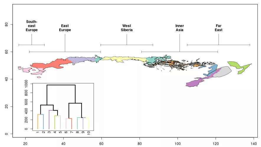
As with all such multi-source, synthesizing work, the delineation published in 2018 was fraught with uncertainties. Not to mention the division of the zone into regions, which has been the subject of scientific debate for decades. “The long east-west forest-steppe zone is highly diverse in both climatic and vegetation terms. Many researchers therefore propose to divide the zone into several regions but rarely agree on the location of the regional boundaries. In our 2018 article, we finally identified five regions by synthesizing a number of sources”, reports László Erdős, research fellow at the HUN-REN CER and author of the then and recently published articles.
“Since the delineation of the Eurasian forest-steppe zone and its regions is uncertain, we thought it would be worthwhile to investigate, using appropriate statistical methods, the extent to which it is supported by large-scale climate, i.e. macroclimate. This might reveal where the delineation needs to be refined, or where it is insufficient to explain the zone's distribution by climate alone”, says Ákos Bede-Fazekas, the leader of the research. In the end, the researchers opted for two of several possible methods: predictive distribution modelling and hierarchical clustering. The former method, which was developed primarily to study the potential distribution of species but has also been used successfully to study the distribution of entire vegetation zones, can be used to investigate where the delineation seems too optimistic and where the potential area of distribution could be increased. Even more interesting is the purpose of clustering: “We used the method to divide the forest-steppe zone into sub-units by considering only climate, not the region boundaries from the 2018 article. We then compared these sub-units with the previously defined independent regions and found a surprisingly close match in many cases”, says Bede-Fazekas. Of course, the researchers encountered not only matches but also discrepancies, which pointed to inaccuracies in the regional boundaries or situations where the macroclimate is not the only factor determining the distribution of forest-steppe. In addition to macroclimate, many other factors may be involved. The third member of the research team, Péter Török, professor at the University of Debrecen, points out: „The persistence of woody and herbaceous vegetation, i.e. the forest-steppe zone, is influenced by the base rock, topography, fire, and large grazing animals, not to mention climatic variability”.
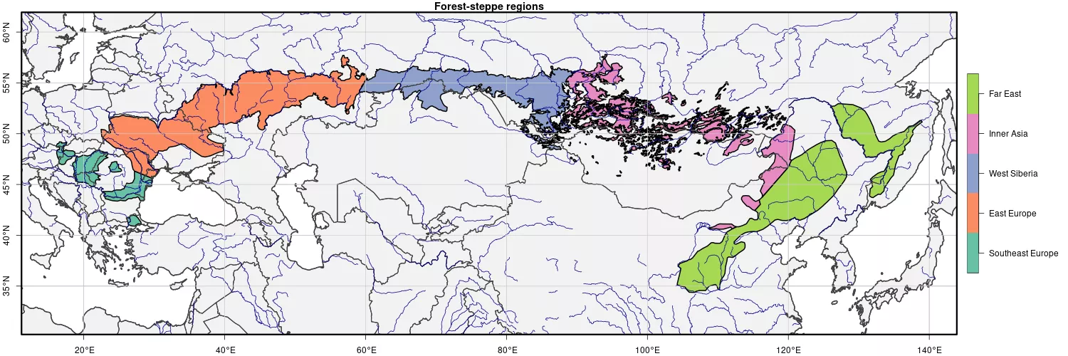
Although the results of the study are best understood by studying the maps it contains, some important findings are worth summarizing. Of the five regions, the central one, West Siberia, showed the strongest agreement, while the Inner Asia region was not confirmed much by the research. Drawing the boundary between the neighbouring regions of Southeast Europe and East Europe will certainly require further research. However, the present research suggests quite clearly that the Far East region should be divided into a southern and a northern sub-region in the future. One of the most important findings of this study is that, however we draw the boundaries between regions, it is not worth studying forest-steppes as a single zone, because a more detailed and more credible picture of the environmental factors determining their distribution can be obtained after dividing them into regions.